Lisbon, the Tagus and the rest / Giulia De Appolonia
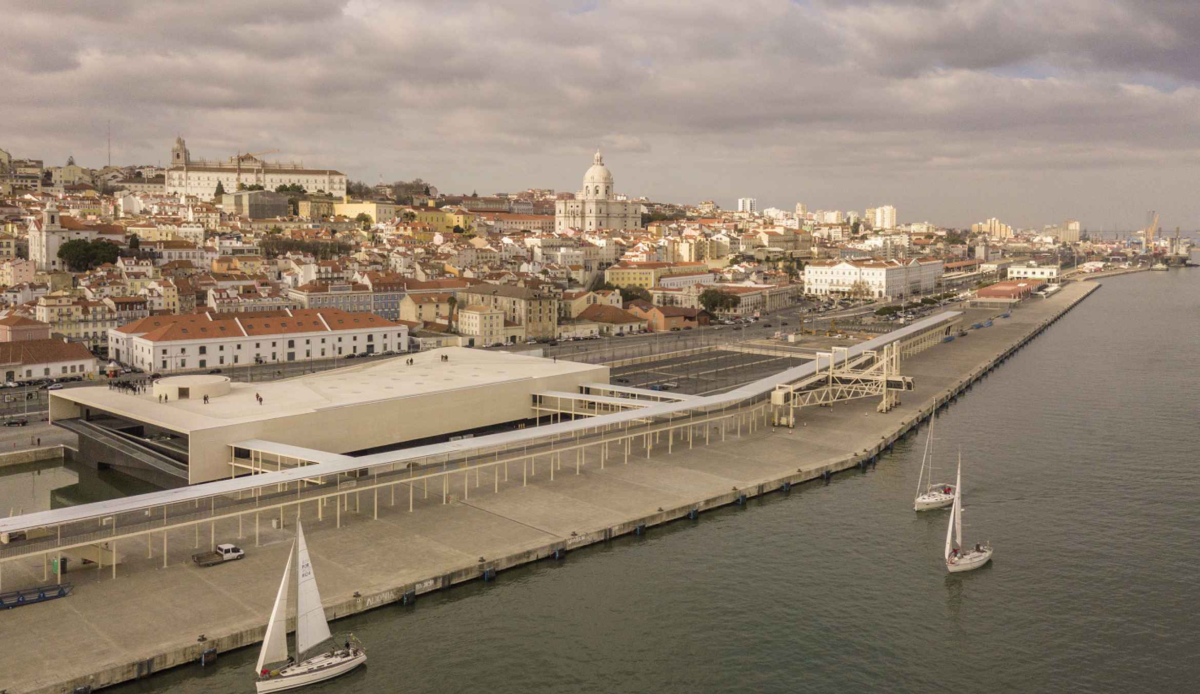
Lisbon’s topography is structured in the relationship with the Tagus River. Characterized by the double condition of protection and shelter, which alternates habitable spaces with observation points on the urban landscape and on the Tagus River, the city features an almost baroque scenography, further dramatized by the light of the river. A light that is found only here and in Venice. The relationship of the city with its river began to change at the end of the nineteenth century, following the industrial revolution, which led to the creation of areas intended for the new railroad lines that replaced the water transport. These twentieth century areas have subsequently grown, with a purely logistical/industrial occupation due to their segregation from the rest of the city, accentuating the distancing of the Lisbonese from the Tagus. The railway line has therefore created an impenetrable barrier on the entire coastal system, with the exception of a location, which has always maintained its contact with the water: Terreiro do Paço, a huge plaza with one side facing the Tagus.
With the progressive abandonment of the railway transport system in favor of the road transport, the Lisbon of the second half of the twentieth century underwent a substantial modification in its internal geography. This fact progressively relieved the riverside of its logistical duties. The change of the coastal strip can be symbolically identified with two major urban interventions, both deriving from world exhibitions, specularly located with respect to the Terreiro do Paço, which have defined the limits of the regeneration area of the Lisbon waterfront: the Portuguese World Exposition of 1940 and the Expo ’98. The former was located in the western area of the city, in Bélem, in front of the Jerónimos Monastery, where, at the end of the 1980s, Vittorio Gregotti and Manuel Salgado won the most important international competition for the construction of the largest cultural building in the country at that time: the Bélem Cultural Center (CCB), initially built to host the works of Portugal’s European Union Presidency. Galvanized by this experience, Manuel Salgado and his studio later designed the central space of Expo ’98, creating an opening of the city towards the east.
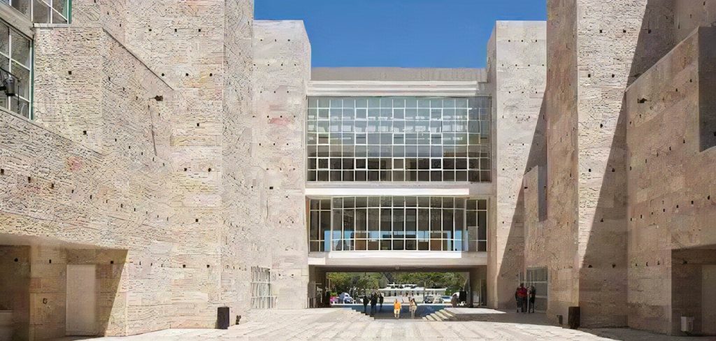
After this experience, Salgado abandoned the free profession to take on political roles in the Municipality of Lisbon, primarily that of Town Planning Councilor, and for more than a decade he has been involved in the regeneration of the city, initiating a profound change of its structure which today is mainly perceived in the recovery of the relationship between the city and the river. There are indeed several interventions throughout the river bank creating high quality urban and landscape public spaces, punctuated by the presence of anchor-buildings, designed by important Portuguese and international architects.
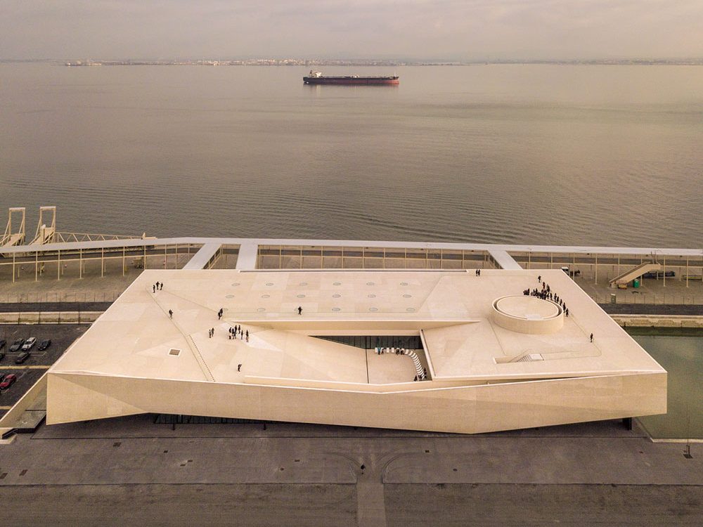
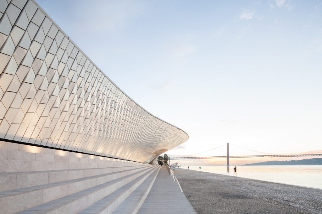
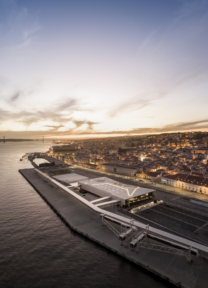
From the National Coach Museum by Paulo Mendes da Rocha and Ricardo Bak Gordon to the MAAT (Museum of Art, Architecture and Technology) by Amanda Levete, who redeveloped a wide riverside area with an Artificial Topography project in which the exhibition spaces are extension of the public space, with fluid and interconnected spaces, and restored the disused industrial buildings of the EDP Cultural Centre; from the Portuguese Pavilion, designed by Alvaro Siza for Expo ’98, to the recent Maritime Station by João Luís Carrilho da Graça, there are today countless architectural works standing out in the Lisbon waterfront area. In this context Carrilho da Graça plays a major role, by winning several public competitions for large areas of the aterro, such as Campo das Cebolas, where he redesigned the public spaces and created a large underground car park, or the aforementioned Maritime Station and finally the area connecting the two interventions where he renovated the docks.
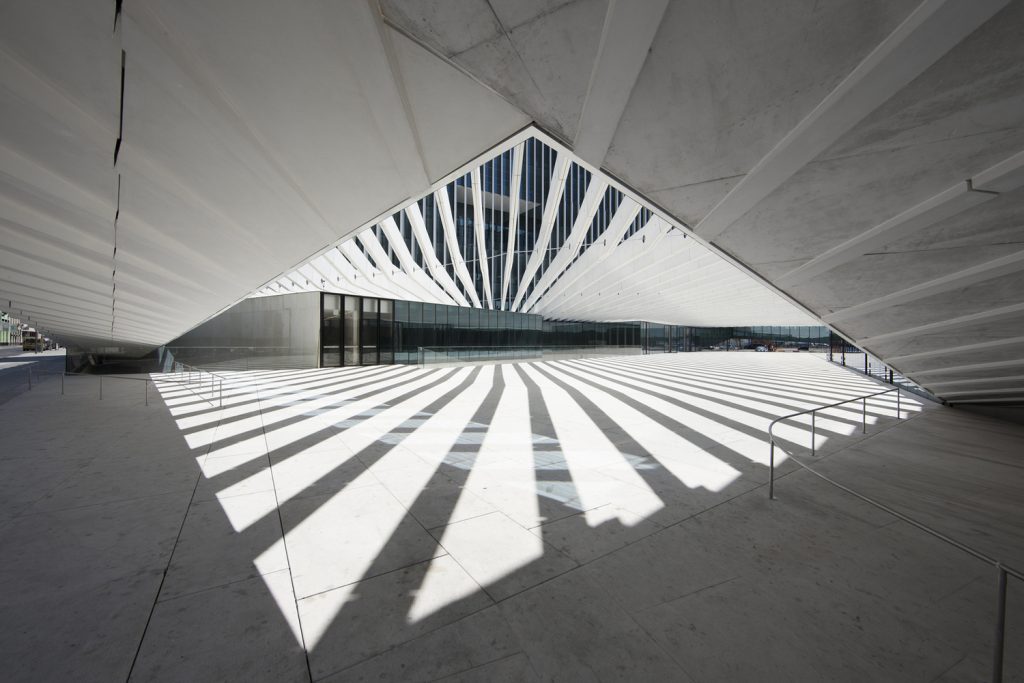
He also designed the aterro of Boavista, which included the new EDP headquarters by Aires Mateus and other interesting projects. On this large platform, which contrasts with the undulating fabric of the city, there are other important projects of buildings and of equally important parks that form a green corridor along the entire arch of the riverside, occupying almost 15 km, designed by landscape architects João Nunes and João Gomes da Silva.
In the next few decades we will certainly see a new organization of the transport and logistics system that will free up the areas around the railway belt that describes to the north of the city an arc symmetrical to that of the Tagus riverfront. Having regained its river, Lisbon now focuses on the inner city, where it is already possible to see various landscape renovations and transformations of the mobility system with the pedestrianization of large areas, in addition to the works, once again wanted by Manuel Salgado as director of the SRU, for the construction of new affordable houses, which represents the focal point of the new development of the city whose center is now massively occupied by projects of the tourism industry.
This massive investment in affordable houses derives from an assignment system based on a curricular preselection, which has designated 20 of the best local architectural firms to develop specific, coordinated projects guided by a preliminary plan by the Aires Mateus which mainly concerns two large areas: Entrecampos, in the city center, and Chelas/Marvila, in the eastern area. The integrated project of Entrecampos includes, in addition to a residential regeneration, a urban rehabilitation with the recovery of the area formerly occupied by the popular fair which is currently undergoing a residential and tertiary reconversion, designed by important architectural firms.
Together with this important initiative to relaunch the residential construction, the city is improving its public spaces through an initiative called a square in each district, which provides for the redefinition of the public spaces with the creation of more pedestrianized areas, the integration of green areas and a general enhancement of the Global Infrastructure Connectivity. Finally, we have to cite the great impact that the tourist boom of recent years had on the development of the city. The strong demand of the tourism-hospitality industry has attracted heavy international private investments in the construction of hotels and luxury residences leading to a decade of wild development, after which the municipal administration is now implementing strong containment and control measures within the urban area to safeguard the quality of life of the city.
